
The Wash is a special place. Fed by four rivers (the Great Ouse, Nene, Welland and Witham), it is one of Britain’s largest estuarine systems and home to a rich range of wildlife. In excess of half a million birds visit each year, either passing through on migration or spending the winter feeding on its extensive mudflats. It also supports a wide variety of human activities, from tourism to fisheries. Understanding where and how the birds use this vast larder is critical to designing effective ways of managing the estuary and its resources sustainably.
In the winter, around 20,000 Oystercatchers feed on cockles and mussels in beds around The Wash; beds which also support commercial harvesting. There is clearly a need to manage the beds such that both birds and harvesting can thrive. But how do we know which beds the birds use? The very thing that makes the Wash special, its size (30,000 ha of tidal mudflats), makes following individual birds using traditional methods extremely difficult.
Recent advances in electronics provide new opportunities for gathering such information. Now lightweight tags are able to obtain high resolution GPS fixes and even send these via the mobile phone network direct to our computers. Together with BTO, WWRG were asked by Natural England and the Eastern Inshore Fisheries and Conservation Authority to tag Oystercatchers so that their feeding areas on The Wash could be identified. Do birds feed freely across The Wash, or do they prefer particular areas? Knowing the difference could have large implications for sustainable management of the fisheries.
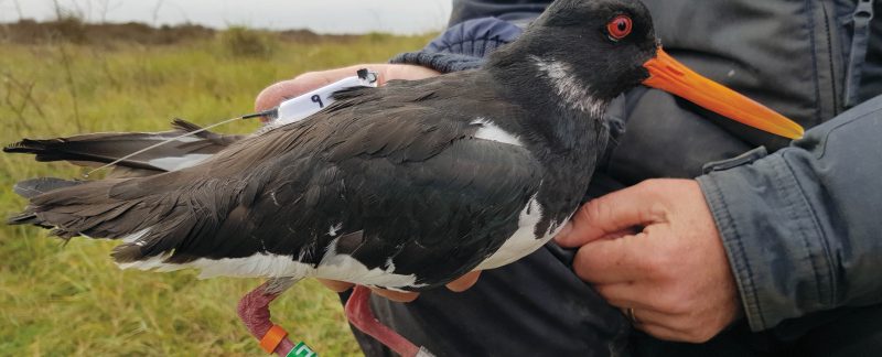
So it was that six group members gathered early on a cold December day to set a cannon-net on the beach. A prolonged wait then ensued… Eventually the tide came in and the birds arranged themselves in the right location for the net to be fired. Ten of the birds caught were fitted with solar-charging tags that weigh only 9 g but which are capable of recording the bird’s location several times a day, tracking their movements as they follow the tide out to feed.
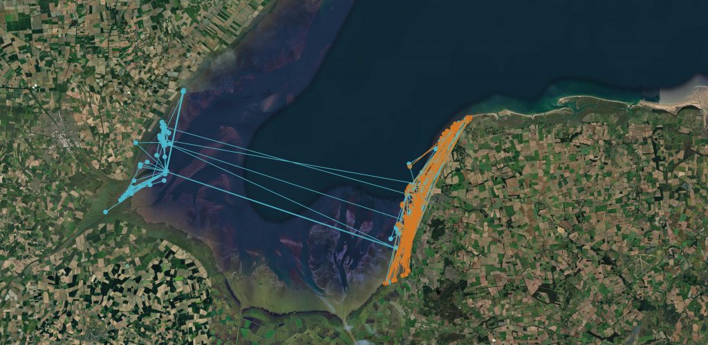
Far from foraging willy-nilly across The Wash, we have found that birds favour particular areas. All birds were tagged near Heacham on the east (Norfolk) coast and most (7/10) stayed firmly on this side of The Wash, as the orange bird in the figure did. Only two ventured, like the blue bird, over to particular areas on the Lincolnshire side for a few days from time-to-time. And the tenth bird? It went on “holiday” to the mudflats near Grimsby, where it stayed for a month before returning to Norfolk – every project throws up a surprise!
These data will help us construct a much better picture of how Oystercatchers use The Wash, evidence that Natural England will use to improve their management advice. As part of this, researchers at Bournemouth University have created a ‘bird-food model’ that assesses how many cockles and mussels the birds need to eat to survive the winter. Currently the model assumes birds can forage freely throughout The Wash, but this clearly seems not to be the case. Fisheries managers already restrict the shellfish harvests to cater for bird food requirements and to prevent disturbance during periods of severe weather. The information gathered enables a more realistic assessment of these requirements and will help guide sustainable management of the shellfish stocks, ensuring The Wash continues to support the many birds that visit each year.
STOP PRESS: Four birds have now (early April 2021) left The Wash for their breeding grounds, one inland in Norfolk and three in Norway (at least two of which visited Denmark on the way). You can follow their journeys here.
We are very grateful to Natural England and Eastern Inshore Fisheries and Conservation Authority for funding and Wash Wader Ringing Group for help with fieldwork.